|
Met Office Shipping Forecasts
0600 Wednesday 24th June |
| Plymouth |
| Gale Warnings |
|
| Wind |
East 3 or 4, increasing 4 to 6. |
| Weather |
Fair |
| Visibility |
Good |
| Sea |
Slight, occasionally smooth at first and moderate later. |
|
| Lundy |
| Gale Warnings |
|
| Wind |
East or northeast 3 or 4, increasing 4 to 6. |
| Weather |
Showers later. |
| Visibility |
Good |
| Sea |
Smooth or slight, occasionally moderate later in southwest. |
|
|
Local Inshore Waters Forecast
Lyme Regis to Land`s End including the Isles of Scilly |
| 0600 Wednesday 24th June |
| 24 Hour Forecast |
| Wind |
North or northwest, becoming variable, 2 to 4, then east 4 to 6 later. |
| Weather |
Fair |
| Visibility |
Good |
| Sea State |
Smooth or slight, becoming moderate later in west. |
| Outlook for following 24 hours |
| Wind |
East 4 to 6, becoming variable 2 to 4, then southwest 4 or 5 later. |
| Weather |
Thundery showers later, fog patches later in west. |
| Visibility |
Good occasionally poor later, but very poor later in west. |
| Sea State |
Slight or moderate, occasionally smooth at first in lyme bay. |
|
|
Local weather info also available from Falmouth
Coastguard on 01326 317575. Please tell them if you are setting
off in a boat or on a remote cliff-climbing expedition.
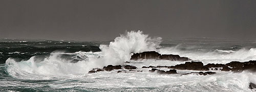
Swell Prediction for Sennen Bay (Height & Direction ) - High Water Time- Height
Updated Daily |
Wednesday 24th June
Very small west-southwesterly swell today becoming west-northwesterly around 3ft or slightly more tomorrow and Friday.
Southwesterly swell between 3 and 6ft on Saturday, becoming westerly later on Sunday.
West-northwesterly swell around 6ft or slightly more with a longish period on Monday; easing on Tuesday. |
| Sevenstones Lightship Wednesday 0600 swell 1ft. Wind at Lands End:- Northeast 2mph |
| Wednesday 24th |
3ft west-southwesterly |
0046; 1325 |
14`8" |
| Thursday 25th |
3ft+ west-northwesterly |
0129; 1425 |
14`8" |
| Friday 26th |
3ft+ west-northwesterly |
0249; 1519 |
15`1" |
| Saturday 27th |
3-6ft southwesterly |
0341; 1606 |
15`7" |
| Sunday 28th |
3-6ft west-southwesterly |
0428; 1649 |
16`1" |
| Monday 29th |
6ft+ west-northwesterly |
0509; 1728 |
16`4" |
| Tuesday 30th |
3ft+ west-northwesterly |
0547; 1805 |
16`7" |
Sennen Bay
Further swell outlook - updated daily - long range forecasts not necesssarily accurate; regularly change significantly, and useful as a guide only ! |
| Wednesday 1st |
3-6ft west-northwesterly |
0622; 1840 |
17`1" |
| Thursday 2nd |
6ft+ westerly |
0657; 1915 |
17`1" |
| Friday 3rd |
3-6ft westerly |
0731; 1951 |
17`1" |
| Saturday 4th |
3ft+ west-northwesterly |
0806; 2027 |
16`7" |
| Sunday 5th |
3-6ft west-northwesterly |
0844; 2106 |
16`4" |
| Monday 6th |
3ft+ west-northwesterly |
0924; 2147 |
16`4" |
| Tuesday 7th |
3ft westerly |
1009; 2235 |
15`7" |
|
Current Actual Weather at
Land`s End
click here
( courtesy John Chappell ) |
| Weather Outlooks - normally updated Sundays and Thursdays. |
| Sunday 21st June |
| Risk of thundery showers midweek - then rain and breezy next weekend. |
| Tuesday 23rd |
Fine in north or northeasterly breeze. |
| Wednesday 24th |
Mainly fine - risk of thundery showers - in fresh east or southeasterlies. |
| Thursday 25th |
Risk of thundery showers - fresh winds between southeast and southwest. |
| Friday 26th |
Rain or drizzle - mist or fog patches - in fresh southerlies. |
| Saturday 27th |
Rain or drizzle in fresh southwesterlies |
| Sunday 28th |
Showers in west or northwesterly breeze. |
| The above information is given in good faith ~ absolutely no responsibility can be accepted for any actions taken on this information. |
|
|